|
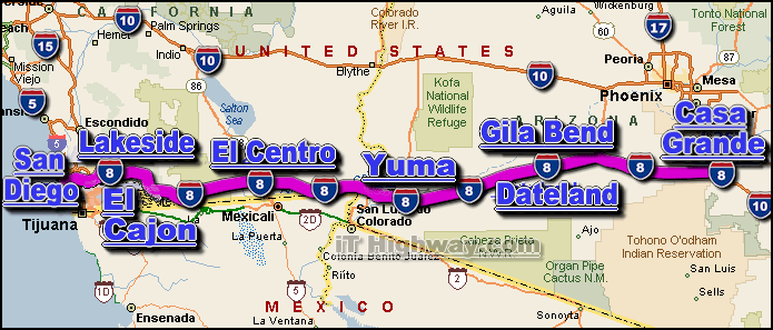
The i-8 is an Interstate Highway that travels generally in a
east-west direction thru 2 US states, those states being; Arizona and
California.The i-8 is the closest Interstate Highway to parallel the
US/Mexico border from the Pacific Ocean in the Ocean Beach area of San Diego CA
inland to just south of the Phoenix AZ region.
The city of Casa Grande AZ is located at it's east end ... and the city of
San Diego is located at it's west end.
The major interstate highways that intersect the i-8 include the;
i-5, i-10, and
i-15.
The i-8 covers a distance of aprox. 350 miles ... which can
be travelled in aprox. 5.8 hrs. with a sustained travelling speed averaging 60
miles-per-hour.
Some of the cities located along the i-8 corridor include;
- Casa Grande,
AZ,
- El Cajon, CA,
- Lakeside, CA,
- San Diego, CA,
- Yuma, AZ,
- SEE ALSO:
i-8 traffic directory.
|