|
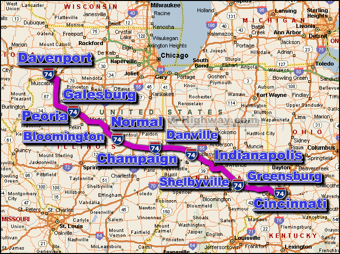
The i-74 is an Interstate Highway consisting of several disjointed sections that
generally travel in a north/northwest-by-south/southeast direction thru 5 US
states, those states being; Illinois, Indiana, Ohio, and North Carolina ... the
map above only shows the contiguous northern section of the i-74 (map does not
show the southern sections in North Carolina).The city of Davenport, IA is
located at it's northwest end - and the city of Cincinnati, OH is located at
it's southeast end (excluding the sections in North Carolina).
The major interstate highways that intersect the i-74 include the;
i-55, i-57,
i-65, i-70,
i-73, i-75,
i-77, i-80,
and i-95.
The i-74 covers a distance of aprox. 417 miles - which can
be travelled in aprox. 6.95 hrs. with a sustained travelling speed averaging 60
miles-per-hour (excluding the sections in North Carolina).
Some of the cities located along the i-74 corridor include;
- Champaign, IL,
- Cincinnati, OH,
- Davenport, IA,
- Indianapolis, IN,
- Normal, IL,
- Peoria, IL,
- SEE ALSO:
i-74 traffic directory.
|