|
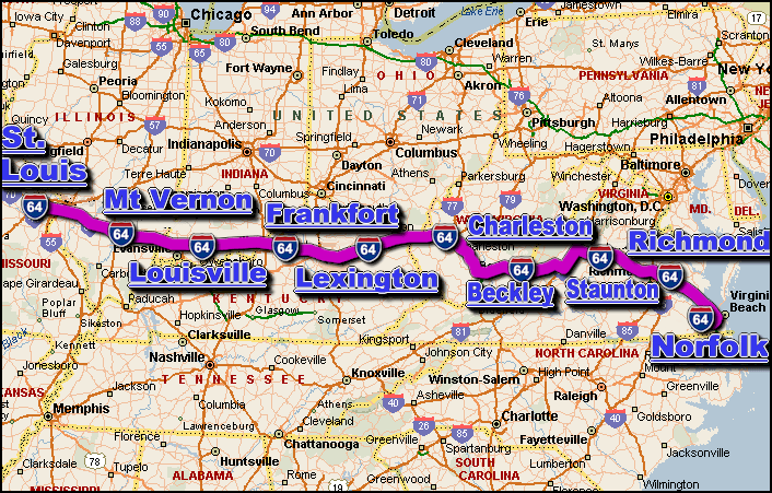
The i-64 is a major Interstate Highway in the eastern US that travels generally in a east-west
direction thru 6 US states, those states being; Illinois, Indiana, Kentucky,
Missouri, Virginia, and West Virginia.The city of Bowers Hill VA is located
at it's east end ... and the city of Wentzville MO is located at it's west end.
The major interstate highways that intersect the i-64 include the;
i-44, i-55,
i-57, i-65,
i-69, i-70,
i-71, i-75,
and i-95.
The i-64 covers a distance of aprox. 954 miles ... which can
be travelled in aprox. 15.9 hrs. with a sustained travelling speed averaging 60
miles-per-hour.
Some of the cities located along the i-64 corridor include;
- Lexington,
KY,
- Louisville, KY,
- Norfolk, VA,
- Richmond, VA,
- St. Louis, MO,
- SEE ALSO:
i-64 traffic directory.
|