|
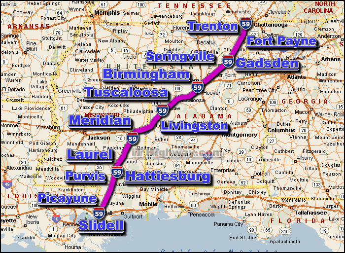
The i-59 is an Interstate Highway that travels generally in a
north/northeast-by-south/southwest direction thru 4 US states, those states
being; Alabama, Georgia, Louisiana, and Mississippi.The i-59 connects
Chattanooga and nearby metro's with New Orleans via Birmingham... and for much
of it's length, the i-59 parallels the older and slower US 11 Highway.
The city of Trenton GA is located very close to it's north end ... and the
city of Slidell LA is located at it's south end.
The major interstate highways that intersect the i-59 include the;
i-10, i-12,
i-20, i-24,
and i-65.
The i-59 covers a distance of aprox. 445 miles ... which can
be travelled in aprox. 7.4 hrs. with a sustained travelling speed averaging 60
miles-per-hour.
Some of the cities located along the i-59 corridor include;
- Birmingham,
AL,
- Hattiesburg, MS,
- Picayune, MS,
- Slidell, LA,
- Tuscaloosa, AL,
- SEE ALSO:
i-59 traffic directory.
|